WALKS WITH NELLIE ~ TITTESWORTH ~ BY SALLY MOSLEY
- Apr 29, 2025
- 3 min read

I fancied a reservoir walk for this issue, so Nellie and I headed off for a trot around Tittesworth on a delightful circuitous path of some 4.5 miles. For the most part we undulated, zig-zagged, ambled and strolled along an ‘upsy-downsy’ clockwise route. We passed quite a few fellow walkers with a succession of assorted dogs, all on leads as instructed by numerous signs.
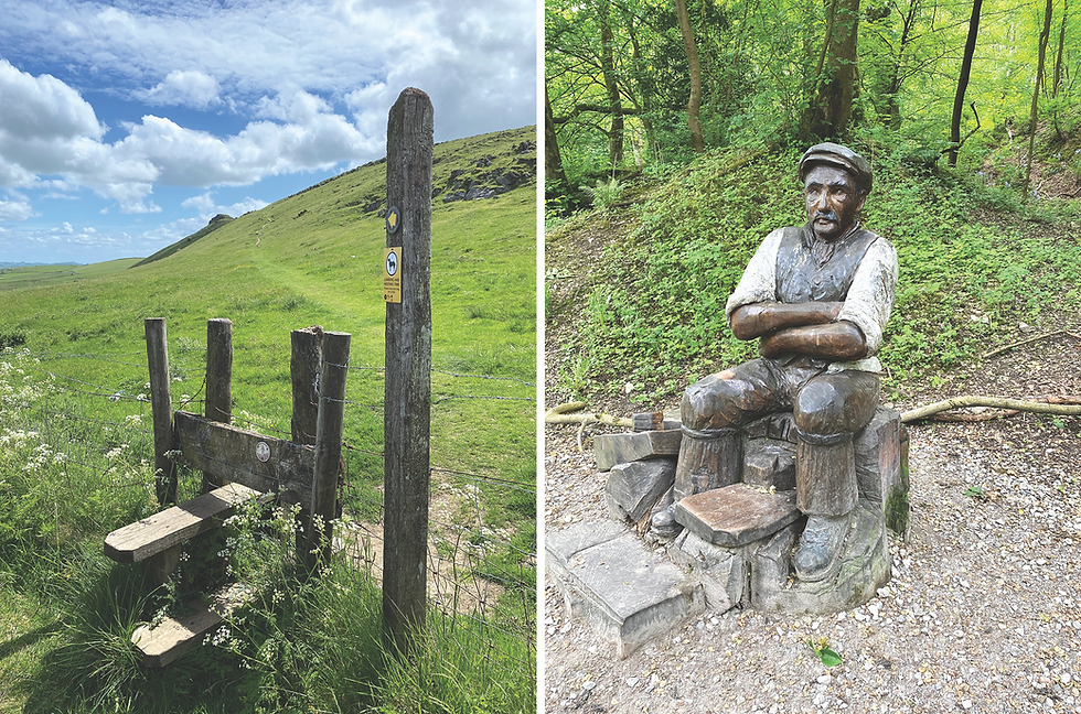
From the pay and display car park we made our way to the Visitor Centre where there is a weird but wonderful sculpture known as the Iron Green Man, created by Jason Turpin-Thomson, a Sheffield artist.
We followed the red dot reservoir walk instructions as indicated by many fingerpost signs. However, it was interesting to see lots of little side shoot paths, nature rambles, hides and viewing platforms as well as play areas and picnic tables close to the car parks as Tittesworth is a very educational and family friendly place to visit.
A lot of the walk was through woodland, walking between coniferous pine and larch as well as deciduous broadleaf trees. At times we passed areas where bluebells were appearing in swathes of colour, but there were also wild flower meadows along the way that looked fit to burst in a rainbow riot of colour. All this is the perfect habitat for moths and butterflies to flutter, bees to buzz and flies to frolic. Being late April there was lots of blossom everywhere, some blown off the trees to create a carpet of confetti beneath my boots and Nellie’s paws.
I really must download that clever app that identifies birds singing nearby, as there were so many different tweets and twitters going on both in the trees and down on the water. Records show that more than 200 bird species have been seen and identified at Tittesworth including migrating osprey that use it as a stopover. In July 2020 there were sightings of western cattle egrets and a laughing gull.
We crossed over the dam wall and looked down onto the treatment plant buildings below. Tittesworth reservoir was created in 1858 by the Staffordshire Potteries Water Works Company to supply the Staffordshire Moorlands area, Stoke-on-Trent and Leek. Originally 51 acres, it was extended in 1959 to 189 acres with Princess Margaret, Countess of Snowdon attending at the official opening in 1962. It is stated that on average 28 million litres of water a day passes through the pumping station, with a possible total capacity of 45 million litres.
The name Tittesworth actually refers to an area that has existed here long before the valley was flooded. It is said to be an Old English word for enclosed settlement, probably belonging to someone called Tet.
From time to time I caught sight of The Roaches and Ramshaw Rocks in the distance, appearing like jagged ‘lost world’ rock formations. Until 1979 that area was private land. In Baddeleys ‘The Peak District’ of 1939 it states “walkers are liable to be stopped by keepers”. With parts now included in the Peak District National Park, this wild landscape abounds with marsh and bog, designated in parts as SSSI and Nature Reserves, with patches set aside for conservation.
The final part of the reservoir walk followed a section of roadway back to the car park. However, a quick detour to the left led me to Meerbrook for a little wander, walking carefully up the narrow main street that contains some lovely properties built of rosy coloured gritstone, quarried locally.
The present Church of St Matthew was built in the 1870’s although there have been earlier houses of worship hereabouts. Just to the south of Tittesworth is the site of Dieulacres Abbey that was founded in 1214 by Ranulph de Blundeville, Earl of Chester. After Henry VIII’s Dissolution of the Monasteries the building was destroyed, its stone used to construct local farms etc. In medieval times a monastic wool industry operated in this region with several ‘granges’ being built in the Leek Frith area.
Evidently part of the village of Meerbrook disappeared in the 1960’s when the reservoir was extended, and somewhere under these hills was the Meerbrook Coalfield that operated from the 1600s until 1878. A drainage sough from the mine was said to be some 4 miles long, being yet another man-made construction associated with water.
Sally Mosley
FOOTNOTE BY NELLIE: Did you miss my little blog in the last issue? It didn’t appear because I couldn’t think of anything to put. Mum said it’s a common phenomenon known as writer’s block, creative stagnation or even imagination drought. A good walk to clear the air didn’t work; a big drink to rehydrate my drought was no good either. Eventually the Editor had to say that I’d reached the deadline and my cut-off point. Now I’m worried what might get cut off? What stress there is in being a writer. Woof woof, Nellie xx